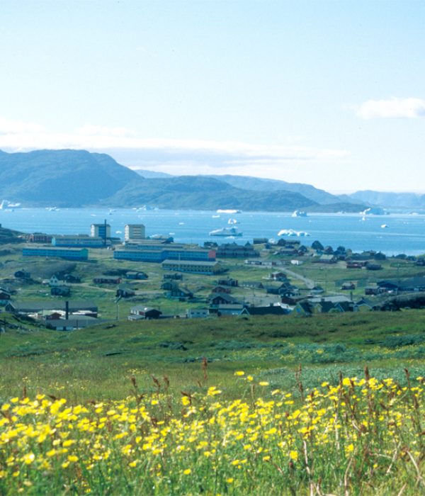
Hiking route Qassiarsuk – Narsaq
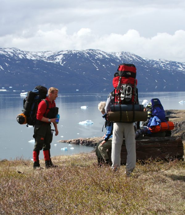
The hiking trip from Qassiarsuk to Narsaq is a classic multi-day hike in South Greenland (3-5 days). You can sleep at sheep farms on part of the tour, but must bring a tent for the leg in the high mountains behind Narsaq. The route can be walked in either direction, but here we describe it from Qassiarsuk to Narsaq. This way you begin with the easy section and the terrain gradually becomes more challenging as you approach Narsaq. From the emergency shelter, it is possible to leave the route and hike down to the sheep farm Ipiutaq. You can spend the night here and, if you are unable to continue on foot, arrange for boat transfer to Narsaq or another destination. This is a beautiful and varied hiking tour that nevertheless requires some orientation and hiking experience.
GPS-track: If you bring a GPS, you can pass by the Blue Ice Café and get the track with waypoints copied to your own GPS. Just remember to bring your GPS cable!
If you have an Iphone, you can also download the app Greenland GPS, which includes the hiking route Qassiarsuk – Narsaq with offline trail maps, points of interest (POI), pictures and lots of other features.
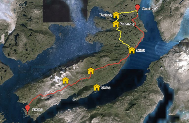
Qassiarsuk – Sillisit – Narsaq. Red route
Distance: About 55 km. 3-4 days. Max elevation 814 m.
Map: Hiking Map South Greenland. Narsaq. 1:100,000
Orientation/difficulty: Gravel road from Qassiarsuk to Sillisit. The route is not marked from Sillisit to Narsaq. Moderate to difficult hiking. Gently rolling hills from Sillisit to the shelter. Steep hills and rough terrain from the shelter to Narsaq.
GPS coordinates: Shelter 1 (above Ipiutaq): 61.013507, -45.741211. Shelter 2 (high route): 60.991112, -45.865834
Accommodation: You can sleep in hostels in Qassiarsuk, Sillisit and Narsaq. You need a tent between the last emergency shelter and Narsaq.
Qassiarsuk – Tasiusaq – Nunataaq – Sillisit – Narsaq. Yellow route
The route between Qassiarsuk and Sillisit can be extended so you pass by the two sheep farms, beautifully located at Sermilik Fjord, Tasiusaq and Nunataaq. Calculate 1½-2 additional days. You can read more about this route under the Qassiarsuk area. From Sillisit to Narsaq you follow the description below.
Route description
The route is described in three steps, but may of course be divided in other ways. It depends on how fast you walk, how much you carry, where you sleep etc. We have described the lower of the two “high routes” from the hiking map (Narsaq 1:100,000), because the higher route through the Nakkaalaaq massif is technically more demanding. We also do not recommend the low route along Ilua and the fjord, as the ascent from the fjord through the gorge and up to the pass above Taseq is not easy.
Qassiarsuk – Sillisit. Approx 15 km.
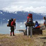
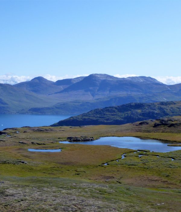
Follow the gravel road out of Qassiarsuk south along the fjord (signpost for the sheep farms Nunataaq and Sillisit). The road winds its way up and after about 2 km splits into two. You take the left fork to Sillisit. It continues upwards through a landscape of green mountains and small, blue ponds, before it descends to the fjord again and passes by the Inneruulalik sheep farm. From here, it is an easy walk along the fjord for the next 6 km, except for a hill of about 100 metres in height along coast. 1½ km before Sillisit you pass by the Issormiut sheep farm.
Sillisit – Naajat – Emergency shelter. Approx 15 km.
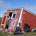
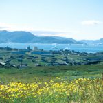
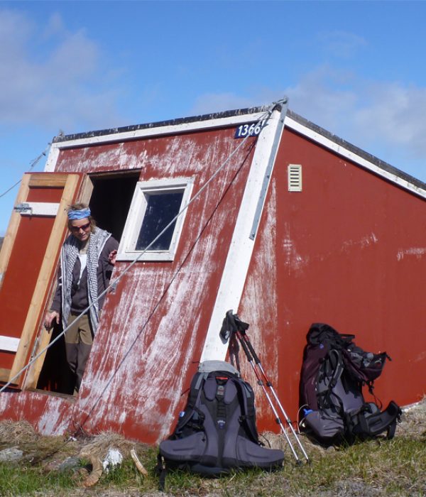
From Sillisit you head down to the fjord and follow the gravel road heading south along the fjord towards the fields. The road continues upwards to the last field and after that you continue on the sheep track south overlooking Tunulliarfik fjord. As you approach the mountain with an antenna at its summit (part of the Naajat mountain), follow the path inland. It rises up through the ravine just to the right (northwest) of the antenna. The antenna is a so-called “repeater station”, which is designed to boost radio signals, and there is an excellent view from the top. The toughest climb is over now and can walk almost in a straight line, over relatively level terrain, from here over the next approx. 8 km to the emergency shelter! You follow the sheep tracks in a south-westerly direction between ponds and through a landscape with moss and heather, which during periods with heavy rain can be a little wet. Just before you reach the shelter, you will find a stream, which you may have to wade if it has rained a lot recently. The emergency shelter is a small, red cabin, with a platform where 3-4 people can sleep in the event of bad weather. There is no other equipment. The shelter is not serviced and you should, of course, leave it in the same condition as you found it. Note that from the emergency shelter you can also descend to the fjord and reach the last sheep farm (Ipiutaq) before Narsaq. Here, you can book a transfer by boat or stay overnight.
Emergency shelter – Narsaq. Approx 25 km.
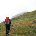
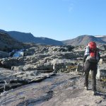
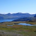
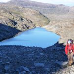
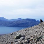
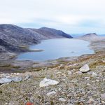
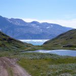
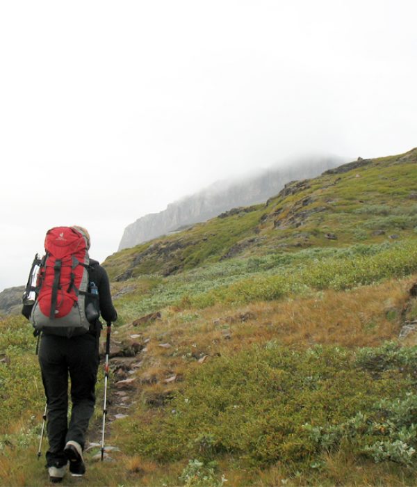
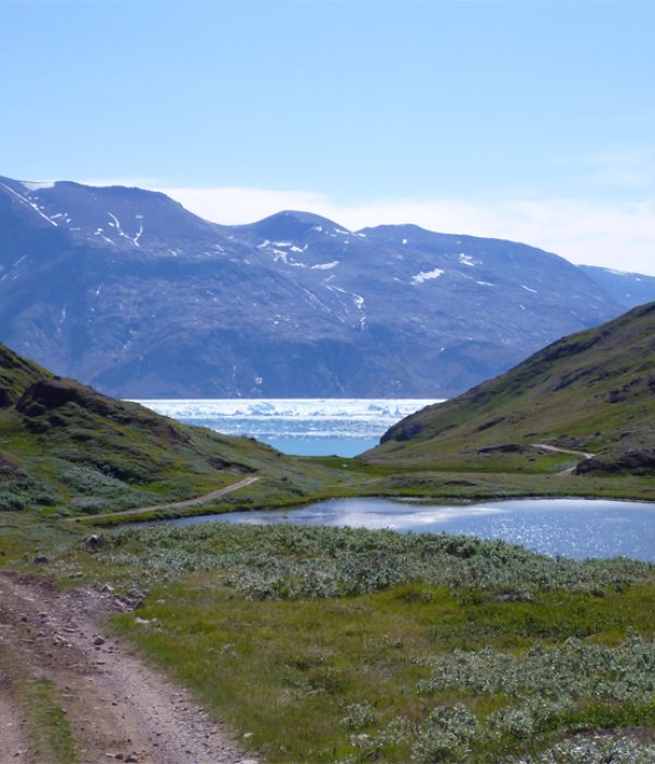
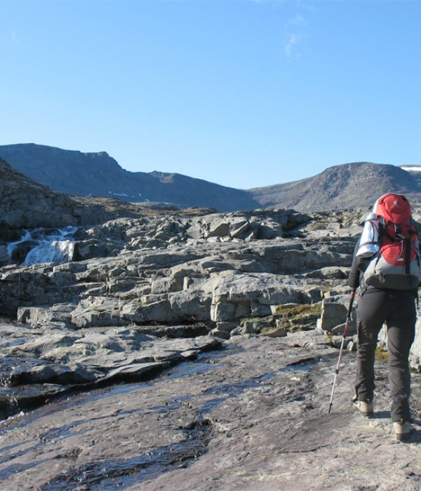
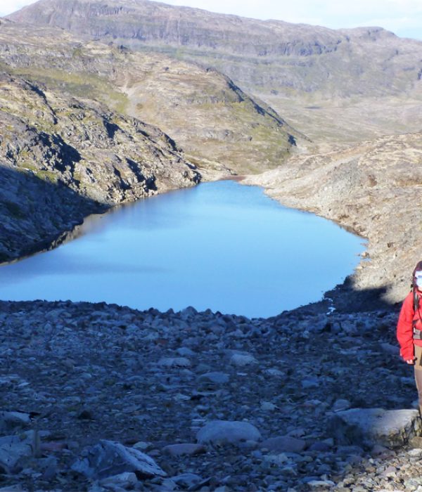
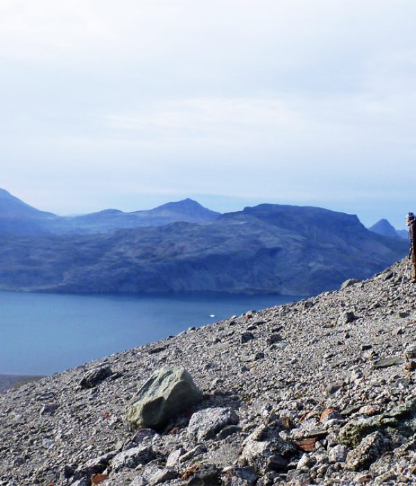
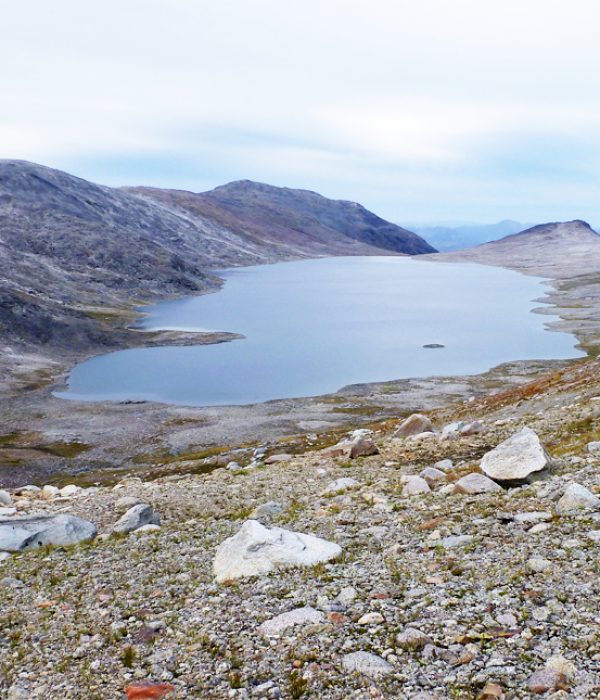
From the shelter to Narsaq the sheep tracks become less frequent. It is also on this part of the route that the terrain becomes rougher and you cross sections with talus and boulders. After you leave the shelter, maintain the same elevation and hike south of the small peak (725 m on the hiking map). Afterwards, head uphill through the pass between the two peaks (723 m and 936 m). Along the way you must force your way through some shrubs and bushes, but once you are at the pass (there is a large cairn), you will find a nice trail for the next 3 kilometres. You walk on a plateau behind the 723 m peak and will soon catch a view of the characteristic ridge on the other side of the fjord named Redekammen (meaning “the hen’s comb”). We recommend that you keep hiking at this elevation until you reach the end of the plateau, and from there follow the small stream uphill. Be careful not to take the first ravine to the left, but the second one, that runs left (west). The terrain consists of rocks and stones, but it is possible to camp at the lake, which lies halfway up the ravine towards the peak. You hike to the pass south of the 1054 m peak, and from there the route descends steeply over boulders interspersed with grassy and mossy areas. At the bottom of this descent, you cross an almost dried-up river and continue up the slope on the other side. Aim for the lowest point. The mountains are rough and weathered, and without any vegetation. Maintain your elevation and continue through the mountain passes until you catch sight of to the big Taseq Lake below you. From here you can follow the cairns down to the lake and along its northern edge. Just before the end of the lake, you follow the cairns west towards the slope that leads down into the valley carved by the Narsaq River. From the top of the slope, you have fine views of the Kvanefjeld Mountain and the road to the old mine, which lies on the other side of the Narsaq River. Hike down the slope until you can traverse to the south-west towards the fields, and continue in this direction almost to the fjord, where you hit the gravel road that leads into Narsaq. Note that the Narsaq River can be difficult to cross. If you want to hike to Kvanefjeld after you descend from Taseq Lake, we recommend that you cross the river by taking a small, concrete bridge that is located roughly at the elevation of the old mine. The river is often not safe to cross by wading, especially if there has been heavy rain!