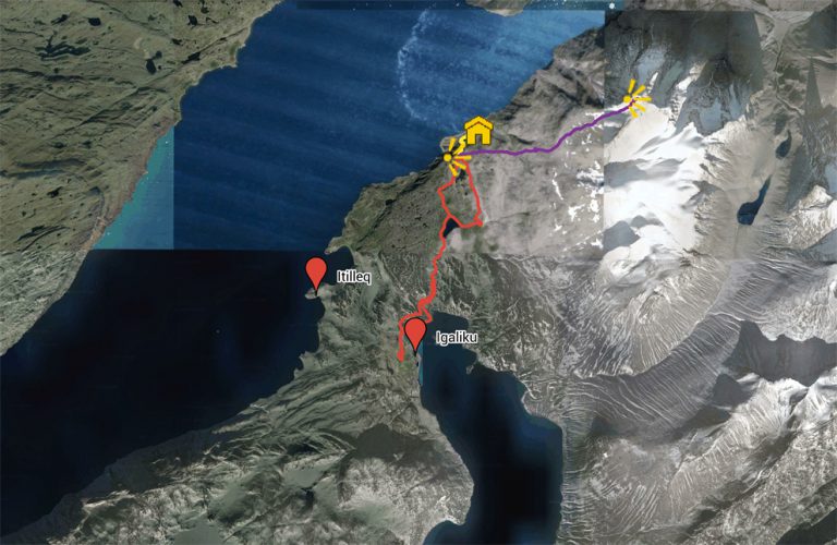


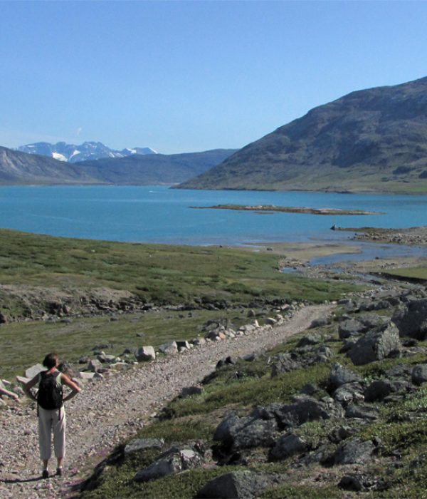
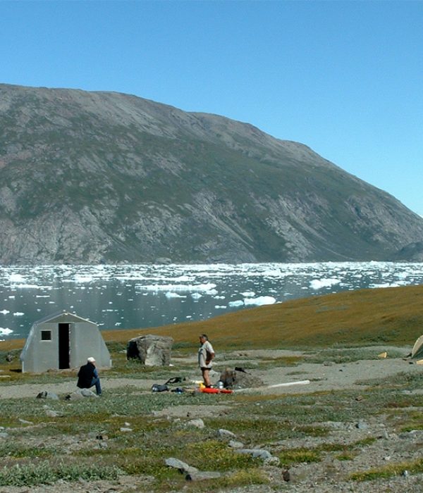
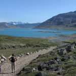
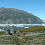


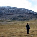
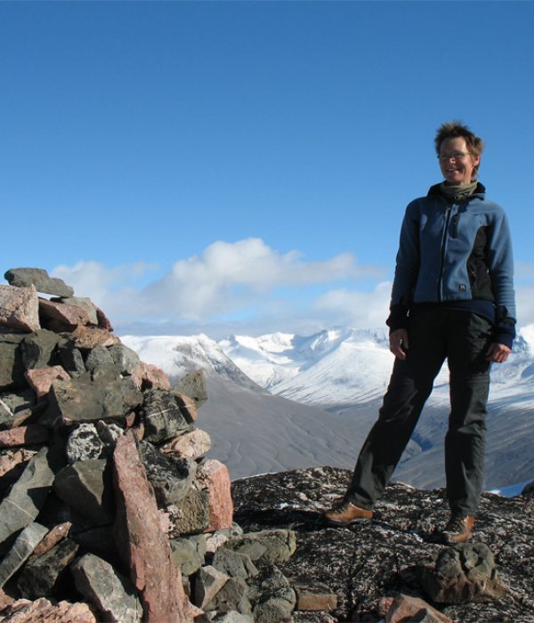
The area around the village of Igaliku includes some of the best hiking terrain you can imagine. The landscape is full of contrasts – from green and lush hillsides to barren rock deserts and rugged mountain terrain. You have views of drifting icebergs, waterfalls and even a lake for swimming! And to top it all off, Igaliku is an absolutely charming and friendly village. It was the Episcopal residence (Gardar) during the Norse era, so there are impressive ruins from that era, but the village’s recent history is also interesting and you can learn more about it at a permanent exhibition in the church.
The tours described here are all day trips starting from Igaliku, where you can stay at the Country Hotel. The colours of the routes refer exclusively to the overview map and have nothing to do with any trail marks on site, nor do they indicate any particular level of difficulty.
Distance: About 17 km. Approx 6 hours. Max elevation 266 m.
Map: Arctic Sun. Narsarsuaq (Qassiarsuk – Igaliku) 1:50,000
Orientation/difficulty: Marked. Easy hiking. Trails and rolling hills.
Accommodation: Igaliku Country Hotel
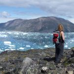
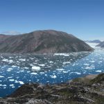
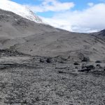
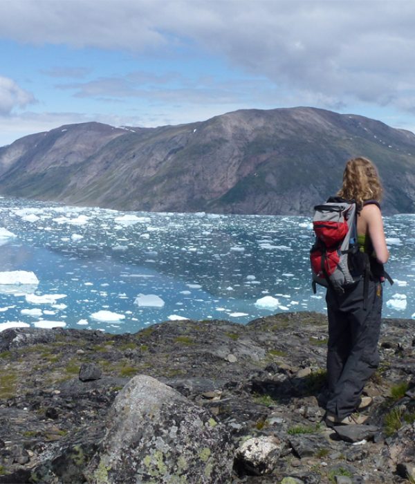
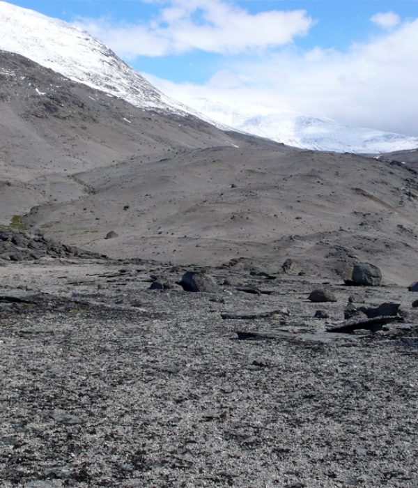
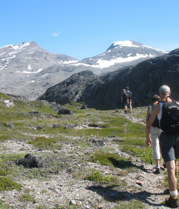
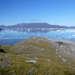
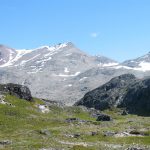
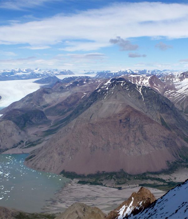
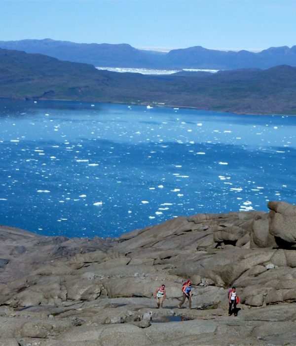
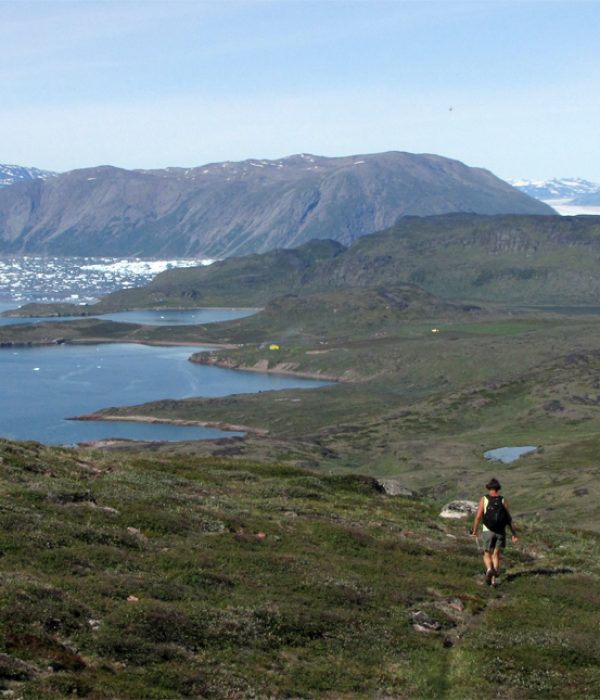
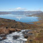
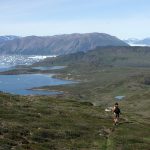
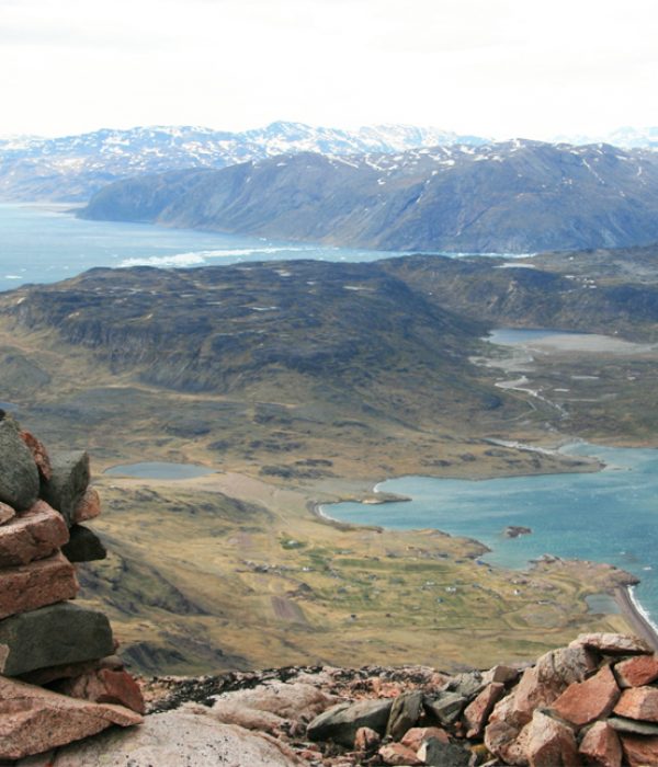
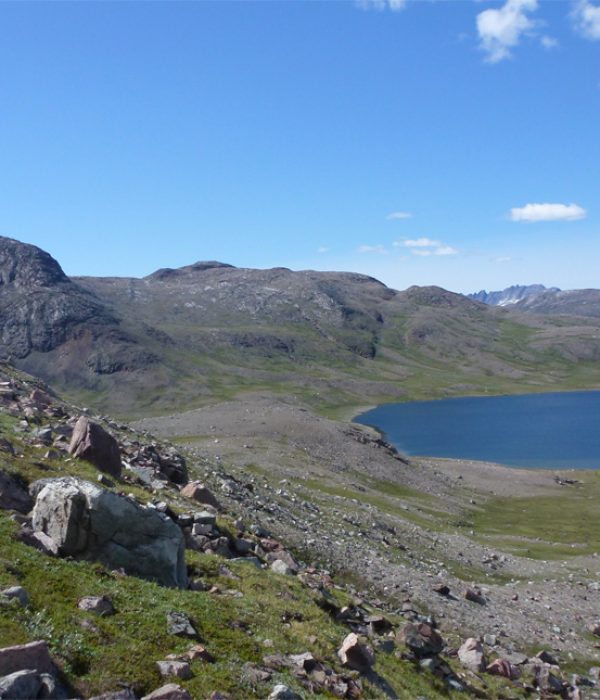
The walk to the plateau is one of the most beautiful and varied tours that you can make in a day. You stroll along a rushing stream, pass through a landscape of dunes, typical willow and birch vegetation, and barren mountain slopes with outstanding views of the Qooroq Ice Fjord. On the return leg you can cross the “moon landscape” – a desert with weathered rocks and stones – and perhaps find a piece of shining “moonstone” (labradorite), the local gemstone.
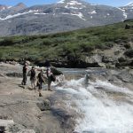
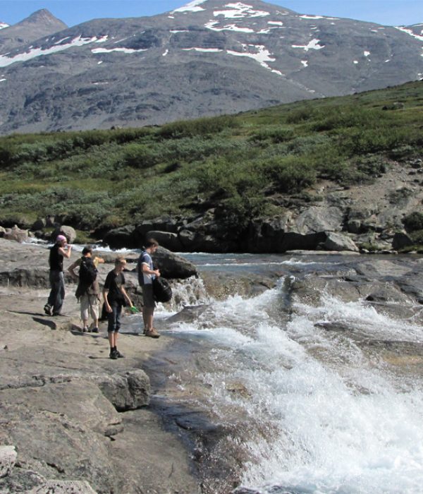
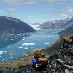
Follow the signs towards “Lake and Plateau”, from the road opposite the cabins at the Igaliku Country Hotel. The gravel road heads out of the village towards the inner part of the fjord. However, after passing through the fence, we recommend that you follow the sheep track marked with red spots along the fjord, rather than take the dusty road, which cuts through the landscape at a higher altitude. After about 2 km you reach the stream coming from the lake and follow it (without crossing it) to the lake. Here the trail merges with the gravel road and continues around the lake. At the end of the lake you follow the marks and the path up through the narrow valley. It ascends about 200 metres before it turns north (right) into a broader valley. Follow the marks over the plateau until you reach the vantage point (signpost), which lies at about 260 m. From here there are spectacular views of the Qooroq Ice Fjord, the glacier at the head of the fjord and the big stranded icebergs on the submerged moraine. On the return, you can take the marked route that goes to the southeast (away from the fjord). You now pass through a “moon landscape” of weathered rocks and have excellent possibilities here of finding the shining “moonstone” (labradorite) along with rock crystals. After about 2 km, you reach the gravel road that leads almost to the top of the plateau on this side of the lake, and you now can follow it back to Igaliku.
Distance: About 10 km. 4-5 hours. Max elevation 266 m.
Map: Arctic Sun. Narsarsuaq (Qassiarsuk – Igaliku) 1:50,000
Orientation/difficulty: Marked. Moderate hiking. Paths and steep/rolling hills.
Accommodation: Tent camping at Blue Ice Camp. Igaliku Country Hotel in Igaliku.
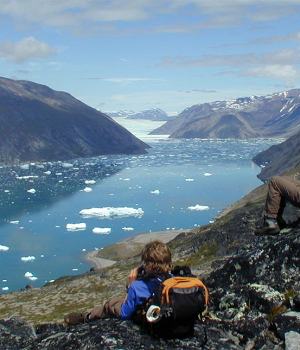
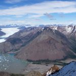
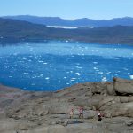
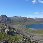
Blue Ice Camp is a base camp located on a tiny, lush and flat area at the mouth of the Qooroq Ice Fjord. It consists of a small aluminium cabin, which is firmly anchored to keep it from blowing away in the strong foehn winds that occasionally sweep down from the ice cap. You should bring your own tent, but can seek shelter in the cabin in the event of bad weather. There is a stove and cooking utensils inside. Blue Ice Camp is a perfect place to spend a few days all alone in magnificent scenery. You can get there by boat from Narsarsuaq for DKK 400 per person (one way). The trail to Igaliku climbs to the plateau, where you can follow the red route down to the lake and Igaliku.
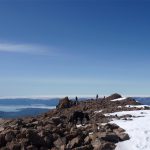
Follow the red spots right behind the camp and along the coastline, heading southwest, maintaining the same elevation. After about 1 km the path zigzags steeply uphill. The ascent to the plateau is approx 250 vertical metres, but it is well marked. The plateau offers a fabulous view of the fjord and the crescent-shaped submarine moraine with its many stranded icebergs. At several places on the plateau there are good opportunities to find the shining “moonstones” (labradorite) and rock crystals. From the signpost at the vantage point you can either take the route through the “moon landscape” down to the lake, or the route (the shortest) through the lush valley. From the lake you follow the gravel road to Igaliku.
Distance: From Igaliku (return) about 30 km. 10-12 hours. Max elevation 1,752 m.
Map: Arctic Sun. Narsarsuaq (Qassiarsuk – Igaliku) 1:50,000
Orientation/difficulty: From the plateau there are no marks. Requires good orientation skills and good visibility. Moderate to difficult hiking. Rough to difficult terrain with talus deposits and snow.
Accommodation: Igaliku Country Hotel in Igaliku. Possibility of camping out in a tent on the plateau, which reduces the walk by about 16 km and 4-5 hours.
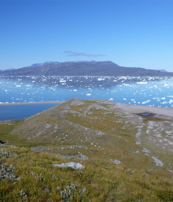
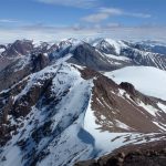
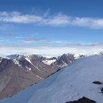
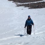
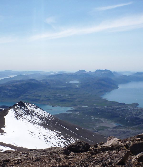
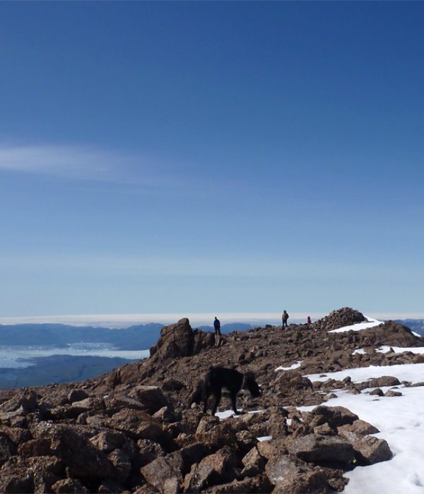
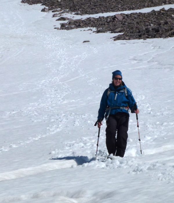
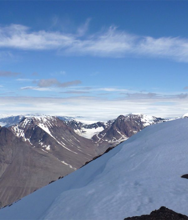
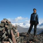
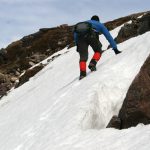
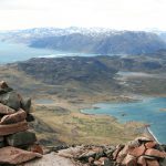
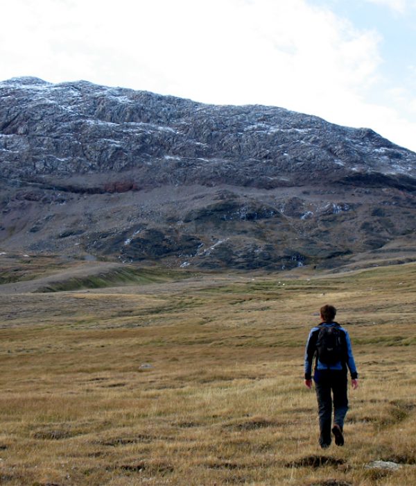
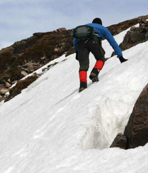
Illerfissalik (Burfjeld) Mountain is the landmark of the entire region. It is a summit you want to climb from the very first moment you see it, and your eyes are constantly drawn towards it when you sail by on the fjord below. The Norsemen called it Burfjeld and legend has it that they maintained a look-out on the summit. When ships arrived from the south, they would light bonfires to signal to all residents of the area that now was the time to gather to trade goods and exchange news. At 1,752 metres, the summit is the highest peak in the area. It does not require climbing skills or equipment to climb it, but it’s not a trip for beginners!
From Igaliku you follow the route to the plateau. From the vantage point (the signpost) on the plateau, you aim directly for the top. The first few kilometres are quite easy in slightly undulating terrain. Then you have to find the best spot to cross the stream that runs down the gorge at Blue Ice Camp. This can vary according to the season and the quantity of water flowing down from above. After crossing it, you continue towards the summit. The terrain now consists of talus and loose rocks, so keep your eyes open for solid rock to step on, otherwise it quickly becomes one step up and two steps down! We recommend that you aim for the lower part of the snowfield that remains between the mountain’s two peaks all summer, then zigzag on the snow to the top. The last stretch consists of large boulders and rocks. The view is of course absolutely jaw-dropping and on a clear day you can see most of South Greenland!
Distance:
Map: Arctic Sun. Narsarsuaq (Qassiarsuk – Igaliku) 1:50,000
Orientation/difficulty:
Accommodation: Igaliku Country Hotel.
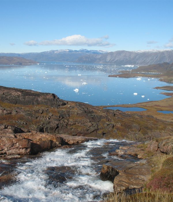
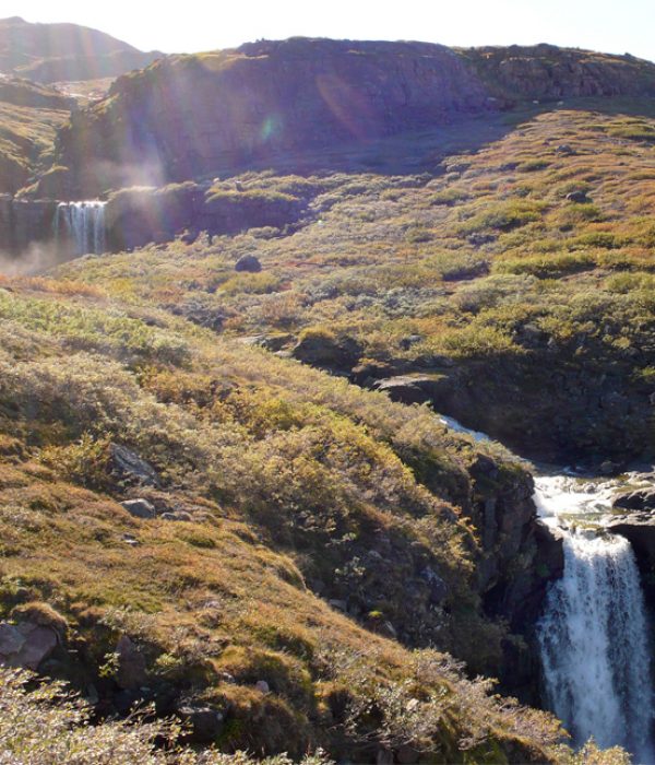
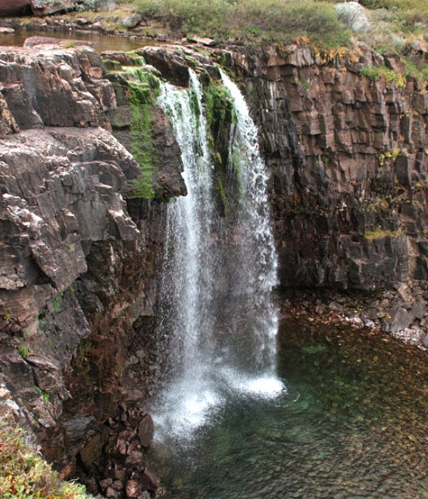
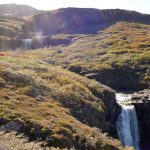
At the Waterfall hike you experience a series of waterfalls that fall beautifully and impressively towards the Tunulliarfik fjord. There is luxuriant vegetation along sheep trails and a beautiful view over the blue fjord with drifting icebergs all the way back towards Igaliku.
Under construction…
Distance:
Map: Arctic Sun. Narsarsuaq (Qassiarsuk – Igaliku) 1:50,000
Orientation/difficulty: The route is not marked. Moderate hiking. Steep hills towards the top.
Accommodation: Igaliku Country Hotel.
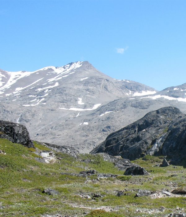
The mountain Nuuluk can be climbed on a moderate walk from Igaliku. With its 823 meters, it offers an impressive view of the area and you get the feeling of true mountains and hillwalking on the way to the top!
Under construction…