Hiking route to Eqalorutsit Glacier
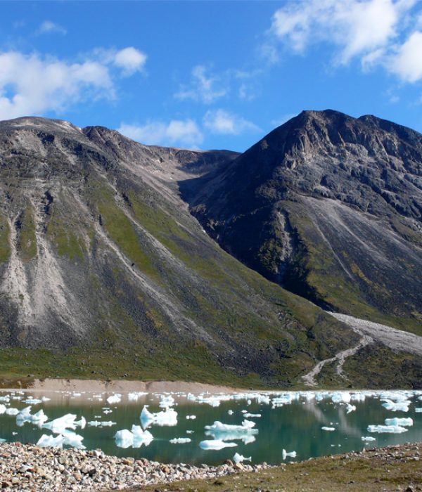
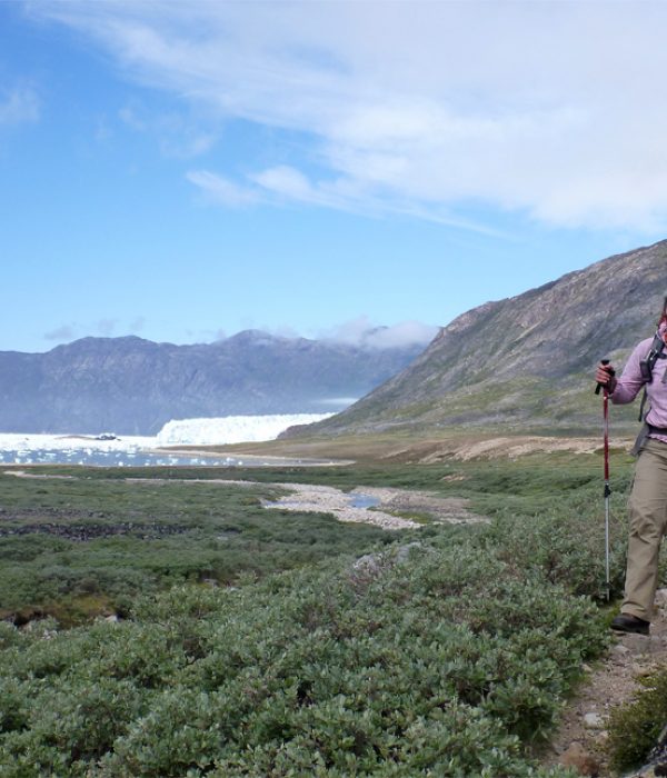
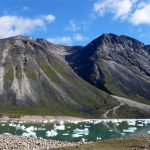
Eqalorutsit Camp is located on a lush flat area in the inner part of Sermilik Fjord, where the mighty Eqalorutsit Glacier produces icebergs round the clock. Eqalorutsit Glacier is one of the most active glaciers in South Greenland and you will hear a constant roaring and rumbling from the glacier and the icebergs and ice floes that it calves into the fjord. At low tide icebergs strand on the sandy beach and a walk among these massive, blue and crystal-like blocks is truly an extraordinary experience. You can also take a fine day trip up to the glacier.
You will need to take along your own tent stay at the camp, but in the event of bad weather there is a small igloo hut where you can seek shelter.
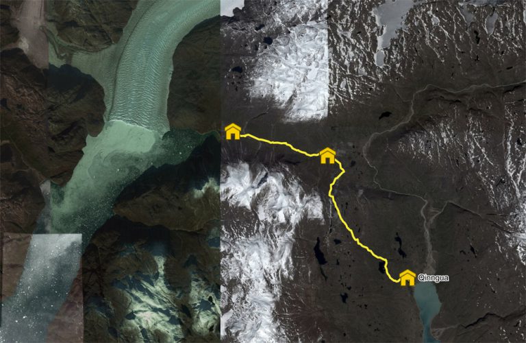
Qinngua – Eqalorutsit. Yellow route

Distance: About 18 km. Approx. 7-8 hours. Max elevation 640 m.
Map: Hiking Map South Greenland. Narsarsuaq. 1: 100,000
Orientation/difficulty: The route is not marked. Moderate hiking. Steep hills and rough terrain over the pass.
GPS Coordinates: The shelter in the valley (5-6 km from the camp site) is located at: 61.300115, -45.603657
Accommodation: Pitch your tent at Eqalorutsit Camp and perhaps at Qinngua.
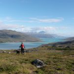
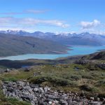
The route over the mountain pass to Eqalorutsit Glacier reach about 600 metres in altitude, but the somewhat hard climb is worth the effort! There are beautiful views over the Tunulliarfik Fjord from the mountain pass. The hike down the slope towards the valley leading to Eqalortutsit takes you through areas with boulders and big stones. In the valley however, it is easy hiking.
Route description
Note that the Qinngua River can only be crossed at its outlet in the fjord near the sheep farm Qinngua Kangilleq (east of the river). The former bridge further up the river is no longer, so be aware of which side of the river you are on, if you come hiking from the Johan Dahl land and are heading for Eqalorutsit Glacier. Eventually check in Narsarsuaq (Blue Ice Café) on water conditions in Qinngua River before heading out on the trip.
The following description starts from the sheep farm Qinngua, which you get to either by hiking along the fjord from Qassiarsuk or by a boat transfer from Narsarsuaq.
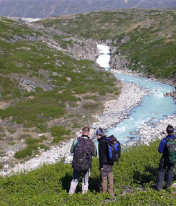
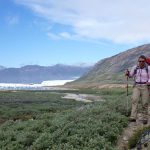
Just south of the sheep farm Qinngua (about ½ km) you leave the gravel road and walk uphill. There is no trail, but the vegetation is mainly low grass, so it is easy to walk. Aim for the lowest point between the mountains and walk along the right-hand shore of the first lake along the way. The route flattens out and you encounter a series of small lakes before you reach the pass and start descending towards the valley. The first leg of the descent is somewhat steep. If you stick to the right side of the little creek, it is easier to cross downstream. The terrain subsequently becomes flatter and you reach the broad valley that leads to Eqalorutsit Glacier. Keep to the right side of the stream and you will find sheep tracks through the bushes. There is an emergency shelter in the valley, just about where you come down from the pass, but the camping conditions are so fine by the fjord, so we recommend that you continue the last 5-6 km towards the Eqalorutsit Glacier.
Stay a day or two at the camp site and make a day trip up to the glacier. On the return, you can vary the route from the pass and make it down into the Paradise Valley (Paratiisi) and from there further on into Qoorlortup Itinnera (the Waterfall Valley), and possibly out to Tasiusaq by Sermilik Fjord (see route descriptions under the Qassiarsuk area).